National Hurricane Center Data
LW Brands, LLC
4.8
Release Details
| Publisher Country | US |
| Country Release Date | 2017-10-05 |
| Categories | Weather |
| Country / Regions | US |
| Developer Website | LW Brands, LLC |
| Support URL | LW Brands, LLC |
| Content Rating | 12+ |
Download the most comprehensive Hurricane Tracker app for iOS.
MAIN FEATURES INCLUDE:
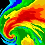
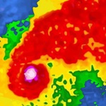
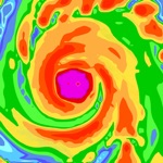
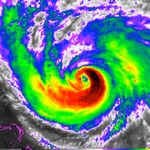
+ GOES Satellite Imagery Animations
+ National Hurricane Center Products
+ National Weather Service Alerts
+ Weather Prediction Center Graphics
+ Tropical Weather Push Notifications
+ Satellite Imagery Home Screen Widget
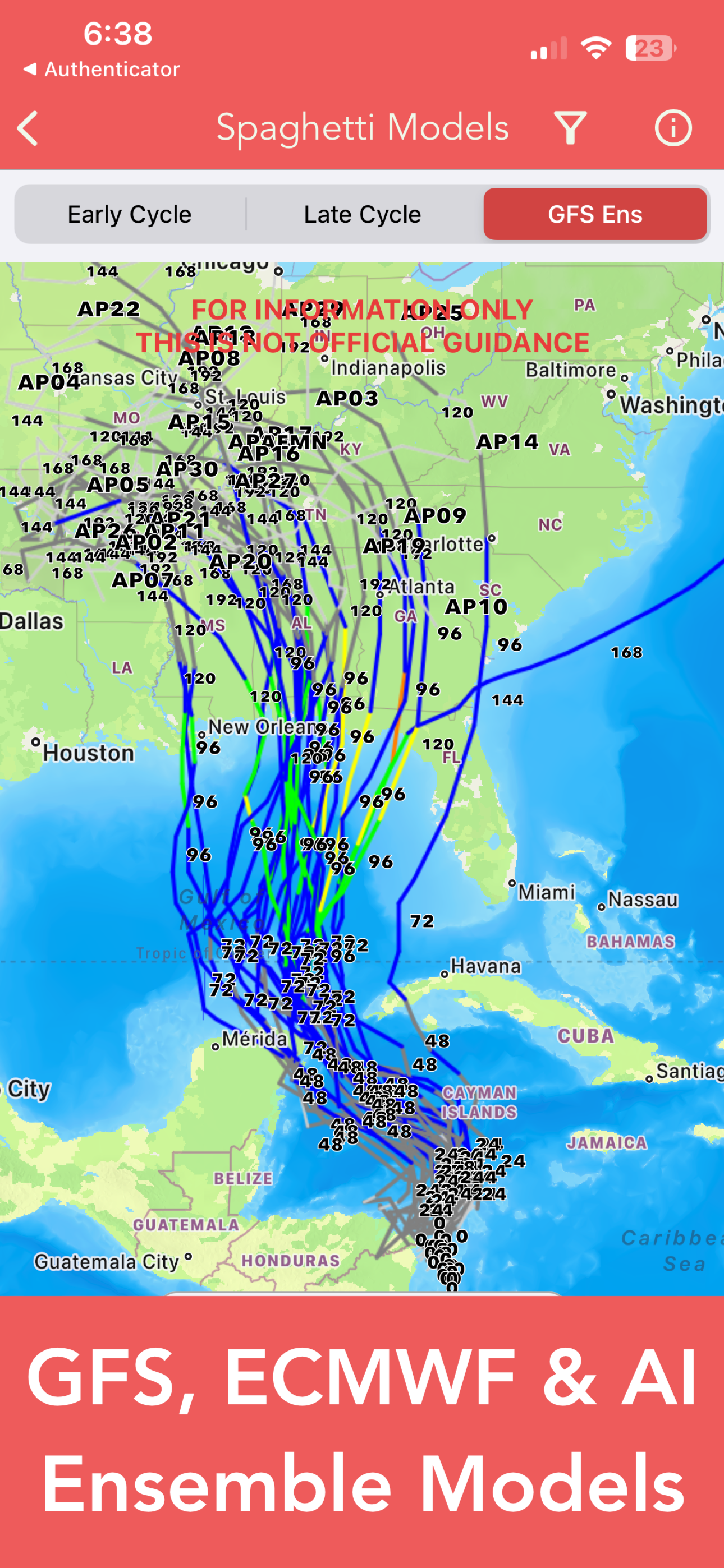
+ Spaghetti Models
GRAPHICAL PRODUCTS INCLUDE:
Forecast Graphics
- Spaghetti Models
- 7-Day Tropical Weather Outlook
- 3-Day Excessive Rainfall Outlook
- 7-Day Quantitative Precipitation Forecast
Storm Specific Graphics
- Key Messages
- Cone Track Forecast
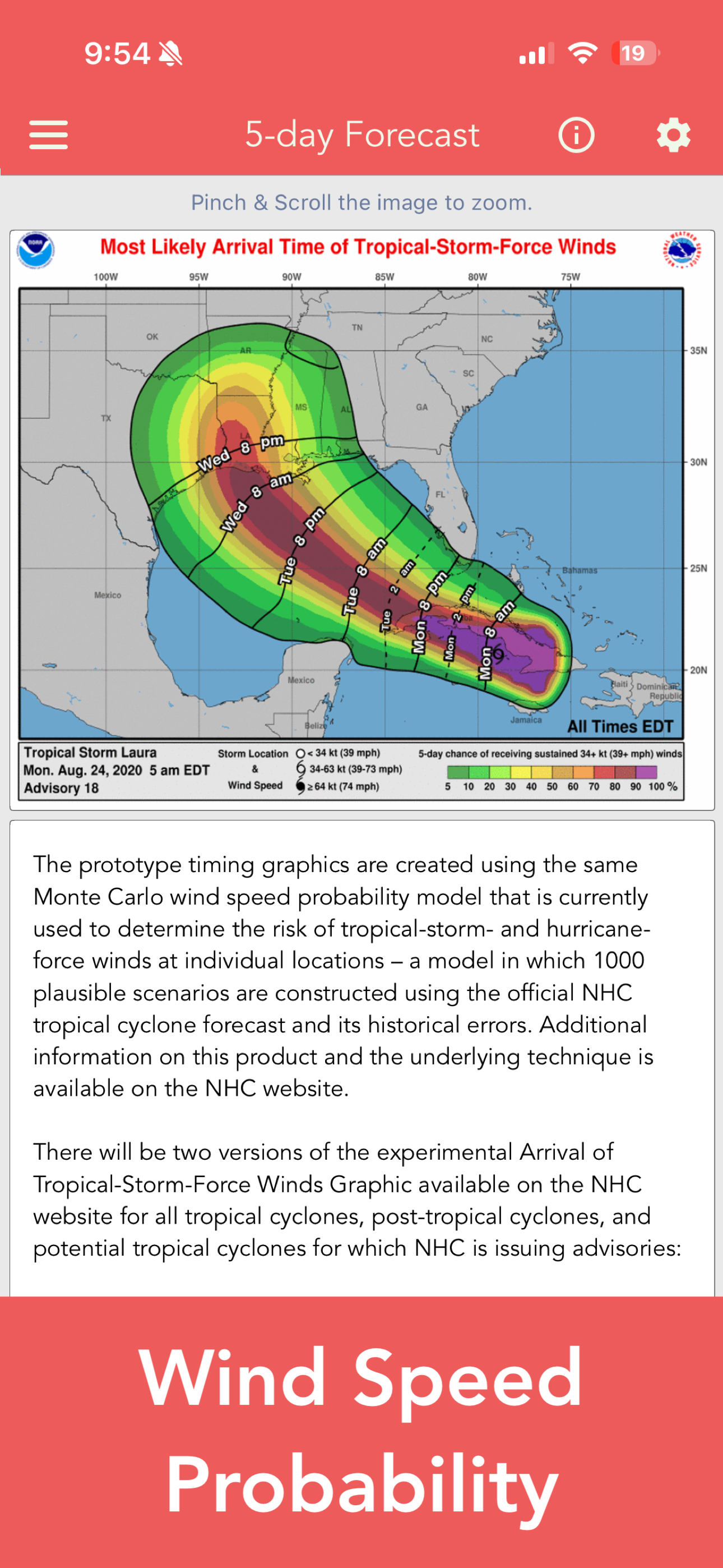
- Tropical Storm Wind (Most Likely)
- Tropical Storm Wind (Earliest)
- Hurricane Wind Probability
- Surface Wind Field
- Surface Wind Analysis
- Wind / Track History
- Rainfall Forecast
- Flash Flood Risk
Local Storm Threat Graphics
- Flooding Rain Threat
- Wind Threat
- Surge Threat
- Tornado Threat
- Rainfall Totals
- Wind Warnings
Note: Local threat graphics are typically not available until shortly before storm landfall.
TEXT PRODUCTS INCLUDE:
- Tropical Weather Outlook
- Forecast Advisories
- Public Advisories
- Forecast Office Discussion
- Local Statement (HLS)
- Local Warnings (TCV)
- Tropical Discussion
- Wind Analysis
WEATHER MAP OVERLAYS INCLUDE:
- Hurricane Track & Intensity
- Potential Storm Surge Flooding
- NASA Sea Surface Temperature
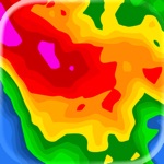
- NOAA Weather Radar
GOES SATELLITE IMAGERY INCLUDES:
Fifteen (15) Satellite Imagery Filters
- Visible (Band 2)
- Near IR (Bands 4 & 5)
- Infrared (Bands 7, 8, 9, 10, 13, 14 & 16)
- Nighttime Microphysics
- Day Cloud Phase
- True Color
- Air Mass
- Sandwich
APPLE WATCH APP INCLUDES:
- View wind speed & intensity updates every 30 minutes
- View the latest satellite imagery
- Choose from a variety of Watch Complications
– PRO SUBSCRIPTION FEATURES –
Full Screen, High Resolution Satellite Imagery:
- Latest Image
- Animated Loop
- Mesoscale: Near Real-time Imagery
- Geostationary Lightning Mapper (GLM)
Mesoscale imagery typically has 1-minute temporal resolution, but is not always available for each storm.
16-day Weather Forecast Models:
- Global Forecast System (GFS)
- Global Ensemble Forecast System (GEFS)
- North American Ensemble (NAEFS)
Weather Simulation Forecast Models:
- Hi-Res Rapid Refresh (HRRR)
- Hi-Res Ensemble Forecast (HREF)
- North American Mesoscale (NAM)
- Hi-Res North American Mesoscale
(NAM-HIRES)
- High Resolution Window
(HRW-FV3, HRW-ARW, HRW-ARW2)
- WaveWatch III (WW3)
- European Centre for Medium-Range Weather
(ECMWF)
- ECMWF AI Forecast System (AIFS)
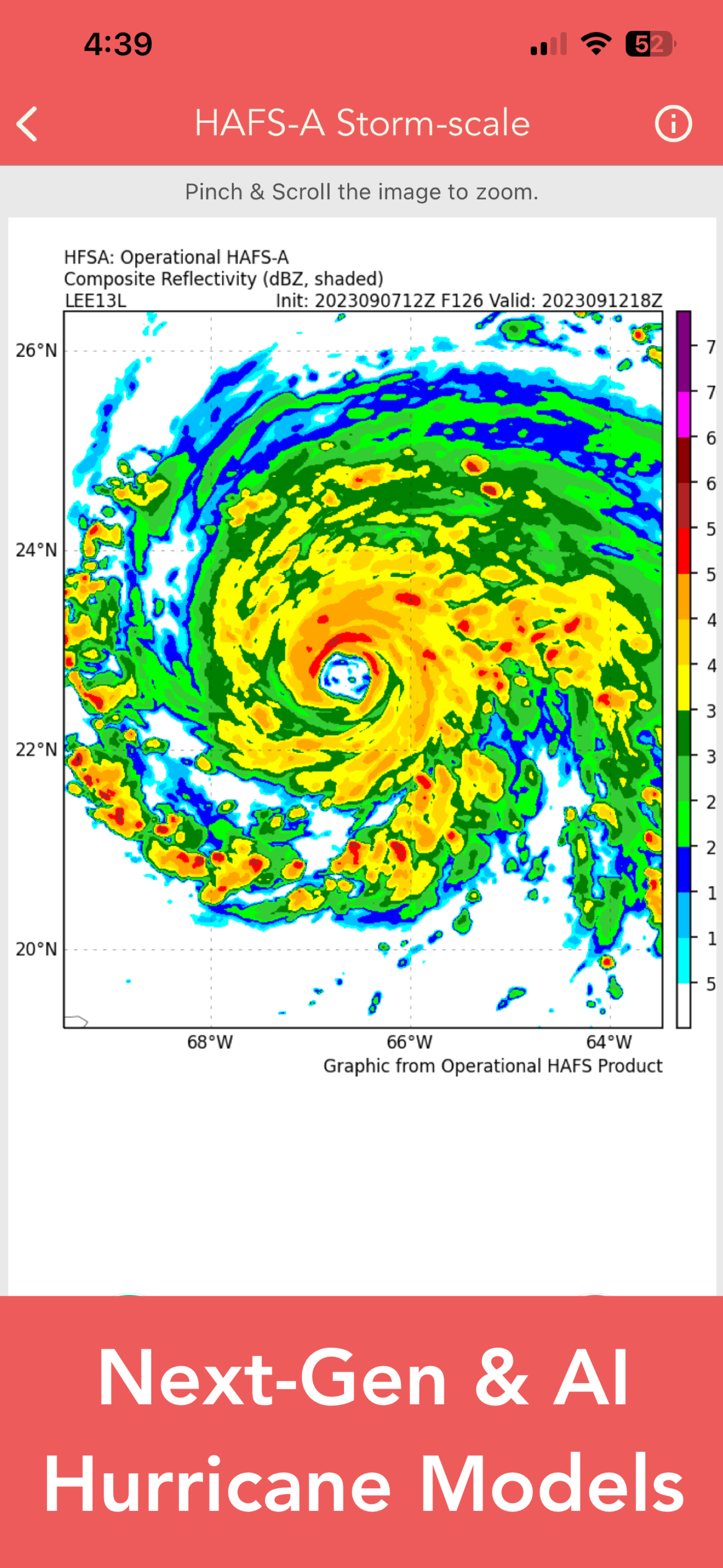
Hurricane Models (HAFS, HMON, HWRF, CTCX)
Experimental Forecast Animations:
- Simulated Radar 2km
- Surface Pressure, Wind
- 200mb Temp, Ht, Wind
- 700mb RH, Ht, Wind
- 850mb Vort, Wind, Thick
Model Analysis & Guidance Animations:
- 6h Total Precipitation
- 10m Wind
- 200mb Vort, Wind, Ht
- 500mb Relative Humidity
- 700mb Vort, Wind, Ht
- 850mb Vort, Wind, Ht
NCEP / ECMWF Cyclogenesis Tracking Products
- 10-day ECMWF Cyclogenesis
- 12-day ECMWF Strike Probability
- 28-day ECMWF Tropical Cyclone Activity
- 10-day Probability of Formation
- 16-day Storm Forecast Tracks
- 21-day Global Tropics Hazards Outlook
- 35-day Long Range Probability
- 15-day Deepmind FNV3 Cyclogenesis
CIMSS Tropical Cyclone Products
- Wind Vorticity & Shear Analysis
- Steering Layer Analysis
- Morphed Integrated Microwave Imagery
- Advanced Dvorak Technique (ADTV9.1)
ADT Includes imagery, wind radii estimates & trends
Interactive Hurricane Tracker Map
- Track & Intensity Forecast
- Preliminary Best Track Analysis
TERMS & CONDITIONS
https://lwbrandsllc.com/hurricane-app-terms-conditions/
–
In total, there are now over 100+ hurricane / weather tracking products to help you stay informed during hurricane season.
Average Rating
74.94K+
Rating Breakdown
Featured Reviews
By Reminded learning curves ahead
2024-11-02
Version 1.52
social_and_communitymonetizationIt was NOT his first rodeo with storms but mine. When I asked husband, a retired USN Captain, was he good with booking the Caribbean beach trip during hurricane season, he said yes. I did book travel insurance that included cancellation & evacuation thinking we’ll leave ahead of storms to be avoided. My experience with storms or living by the sea is just watching the news to see what’s headed in my direction living inland. Then like buying a car, sightings increased as attention to hurricane season threats became popular news items. My concerns about cancelling mounted and focus shifted to what would guide decisions to leave. Asking our son with over 30 years as a first responder that include 20+ in USCG how to monitor for threats — since the “local” newscasts would be Florida-based not our little island — this app was 1 of 2 he sent. SO… when reports of the tropical storm named Helene escalated, this app was SO HELPFUL to provide details that my husband who had lived a decade in NOLA assessing storms that could prompt the fleet to relocate could use now. Meanwhile this app helped me manage my anxiety and decision-making, especially amid the howling winds and pouring rain when the sea state seemed it would reach us ashore. Later as I and others most sadly learned again, forecasts are not the ultimate source of outcomes and the force of water. This app certainly helped this storm newbie and her old sea dog avoid heading home too soon.
By brucereynolds31594
2023-12-14
Version 1.30
feature_requestsgamificationmonetizationupdates_and_maintenanceThis app is critical for anyone who lives in an area with tropical weather/systems. There have been hurricanes where the data in the app (which updates at the same time meteorologists get their update) gets to me faster than the news on TV/online. Living on the Gulf coast of Florida, anyone that’s been here for the last few years knows how many storms have been down to minute changes in course or strength to determine when to evacuate or change plans. This app keeps you 100% up to date and I highly recommend the subscription. With the subscription I usually have a 1-2 day lead on storm development before the news is even talking about it. There are so many features and maps and graphics that I feel like real meteorologists must get about the same data if at all any more. TL;DR This app is as good for the average person as it would be for a trained meteorologist, and is the ONLY app you need to be totally prepared in any hurricane.
By Testing_Testing1234
2024-06-16
Version 1.40
gamificationupdates_and_maintenanceperformance_and_bugsThis app is great for monitoring systems in tropical regions. The information provided in this app has been accurate, timely, and up-to-date with developing systems. I have used this app for over a year and it is a great tools I would highly recommend anyone that lives in a tropical area get this app. It is easy to use and provides the necessary data to track hurricanes. It is not perfect, but I have noticed updates over the last year and am optimistic the trend of improvement will continue. One thing I would like to see is for areas that have the right conditions be reported. It does show areas of interest but there is a delay in the reporting when conditions are right for development verses when there is confidence in something developing. That may not be significant for some, but I am a nosey planner and like to know what is going on out there even if something does not develop. One thing I love are the spaghetti models! Those are fascinating to me.
Screenshots


AD
AD
Hot Apps