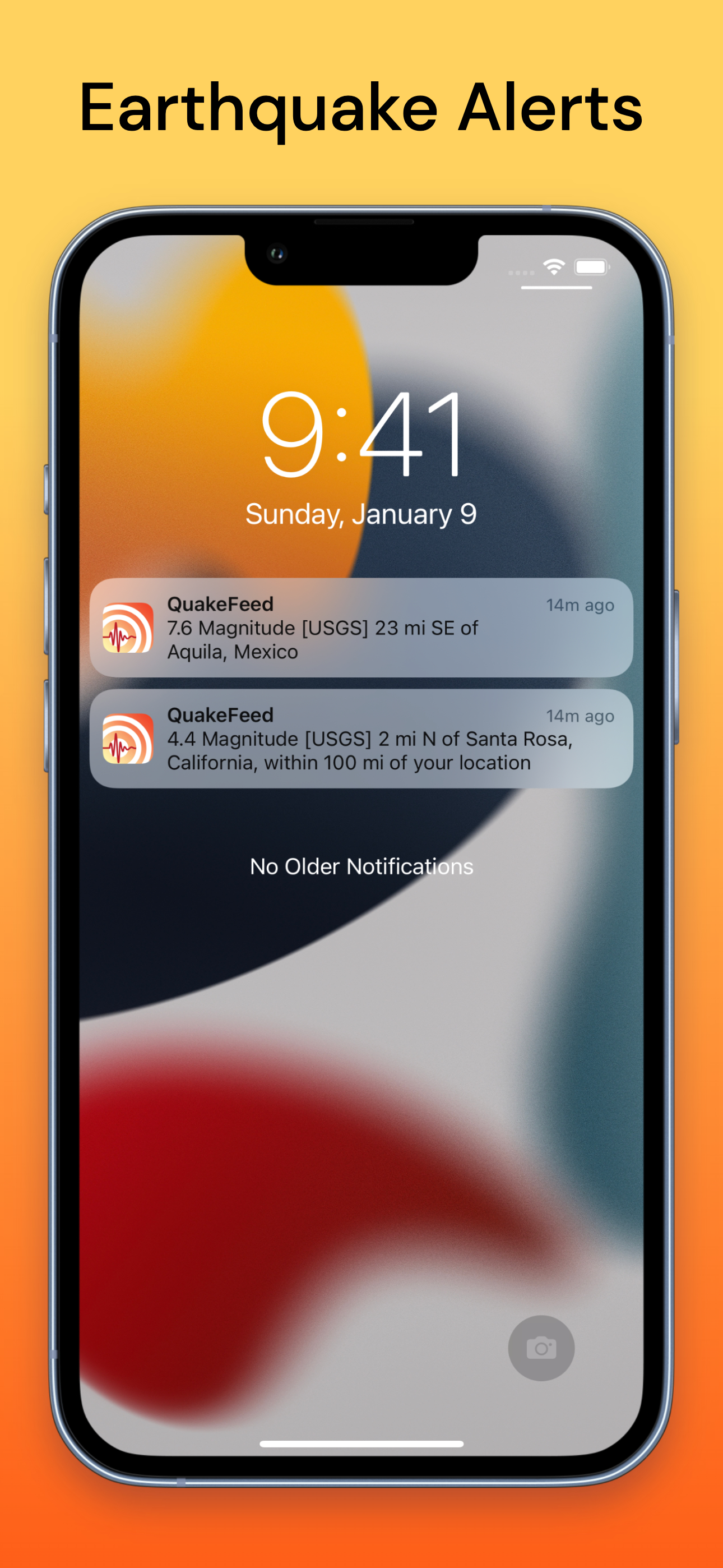
QuakeFeed Earthquake Alerts
Artisan Global LLC
4.8
Detalles de la Versión
| País del Editor | US |
| Fecha de Lanzamiento en el País | 2010-11-30 |
| Categorías | Weather, News |
| Países / Regiones | US |
| Sitio Web del Desarrollador | Artisan Global LLC |
| URL de Soporte | Artisan Global LLC |
| Clasificación de Contenido | 4+ |
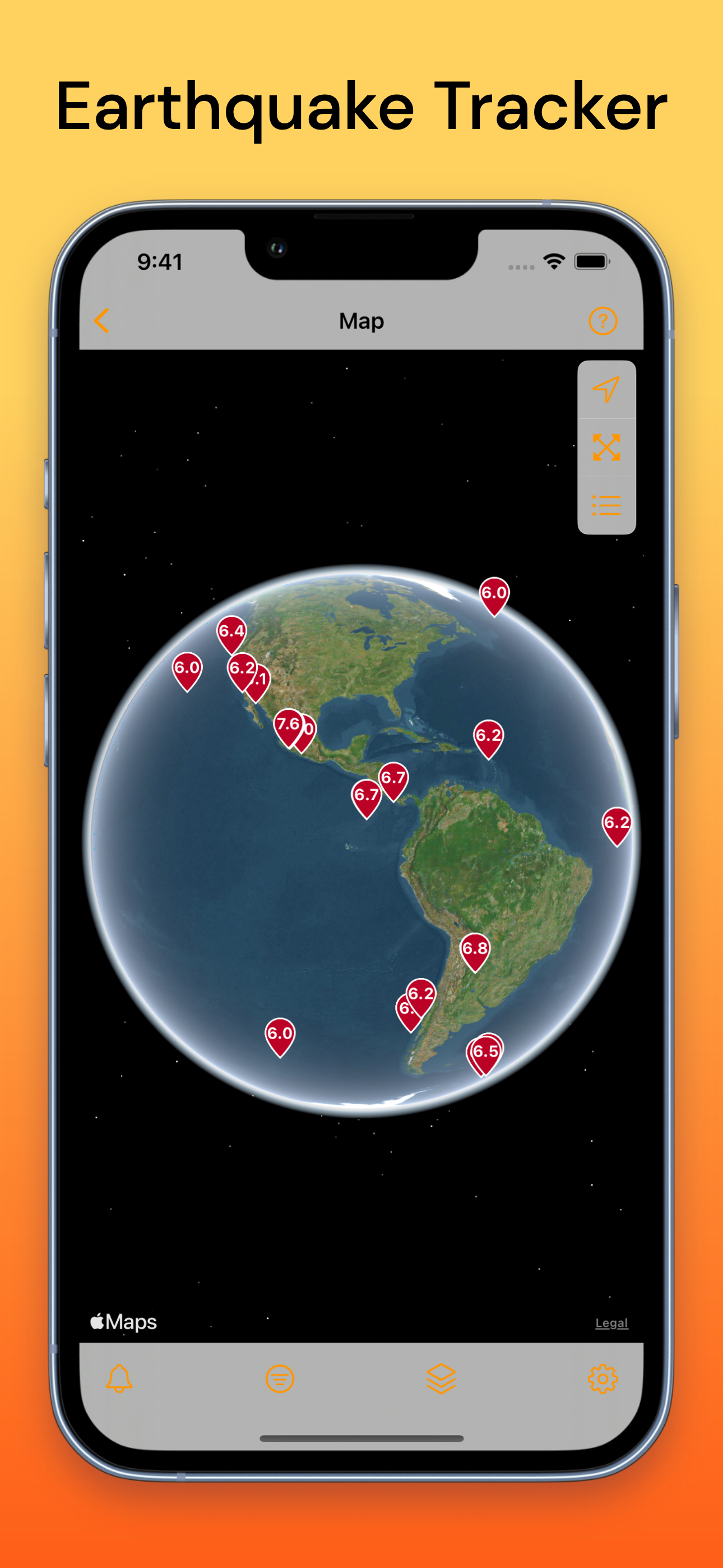
Worldwide earthquake map, alerts, and news.
The most free features of any earthquake app!
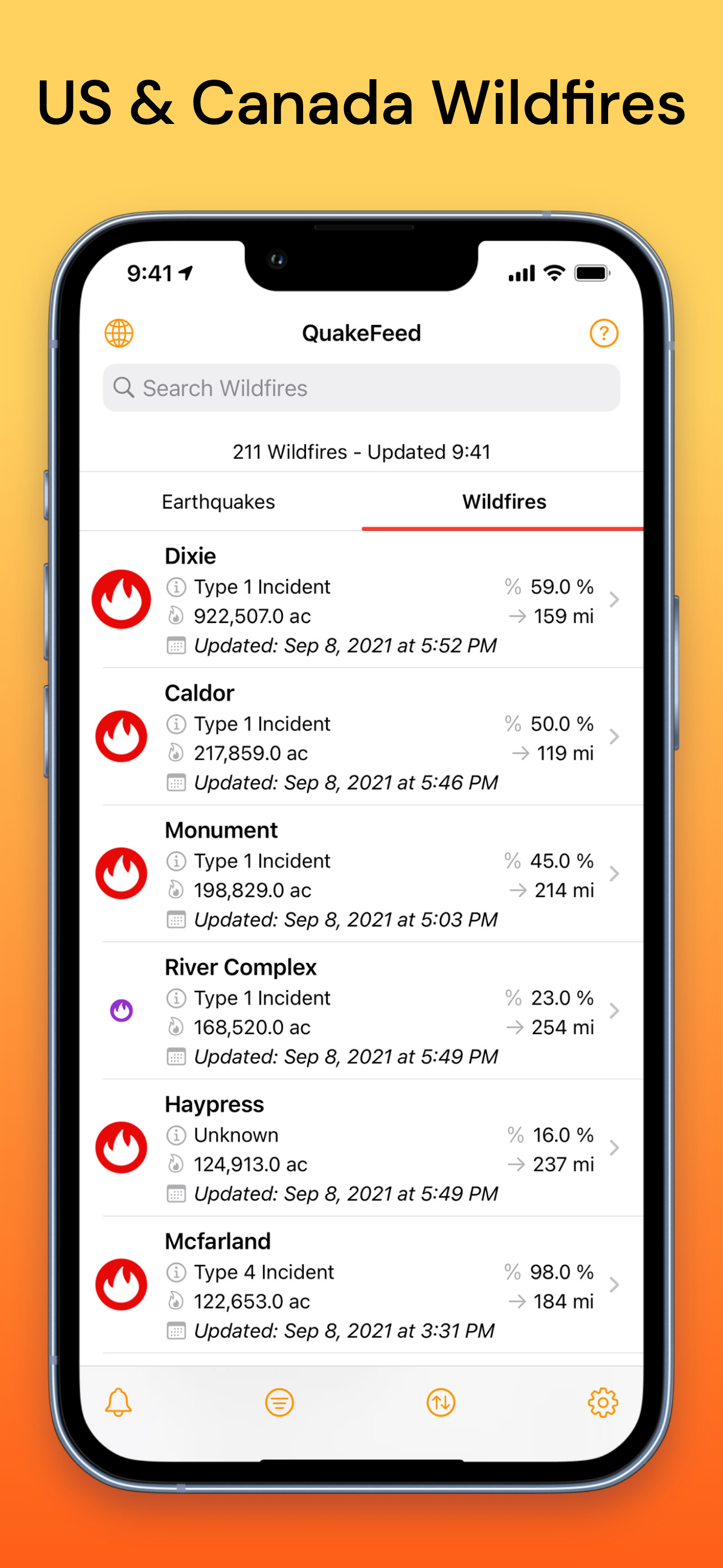
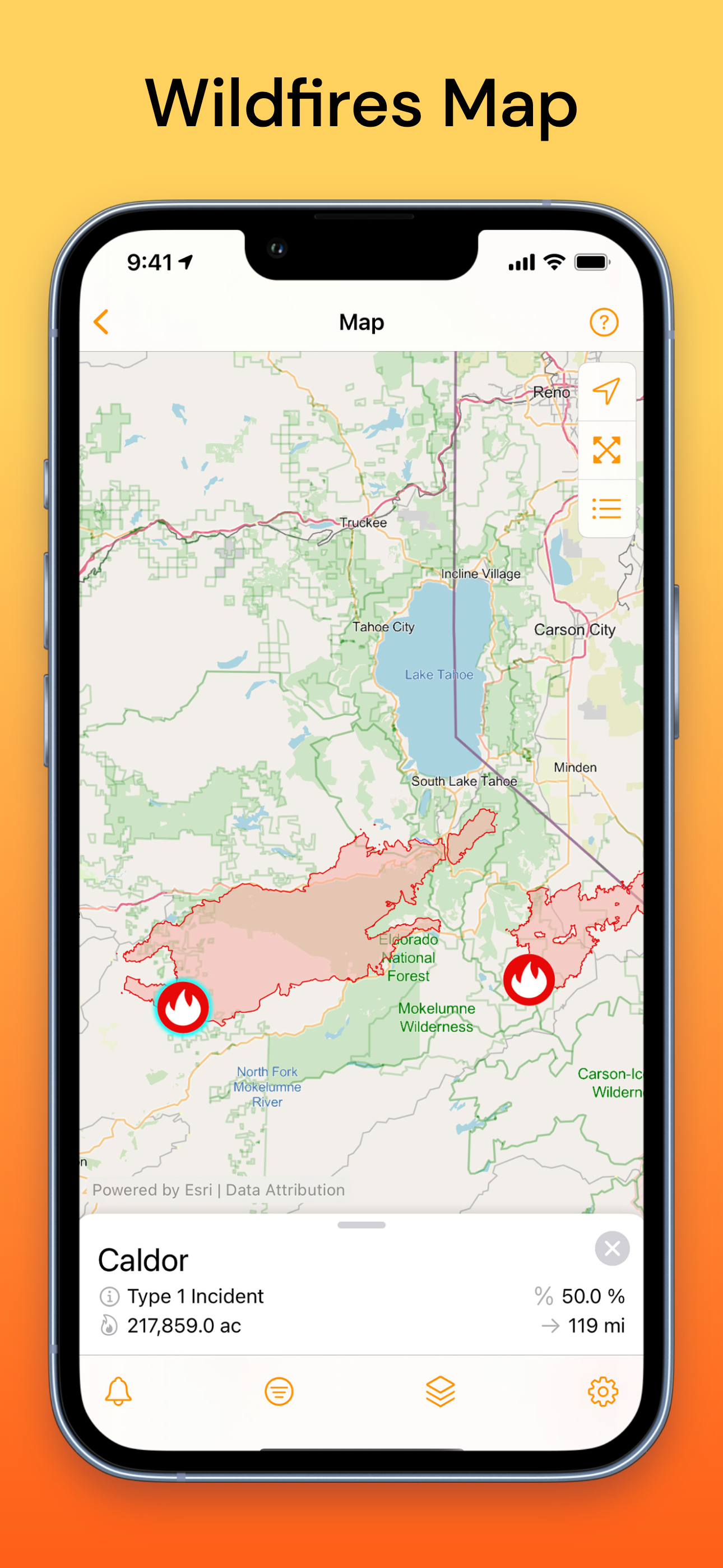
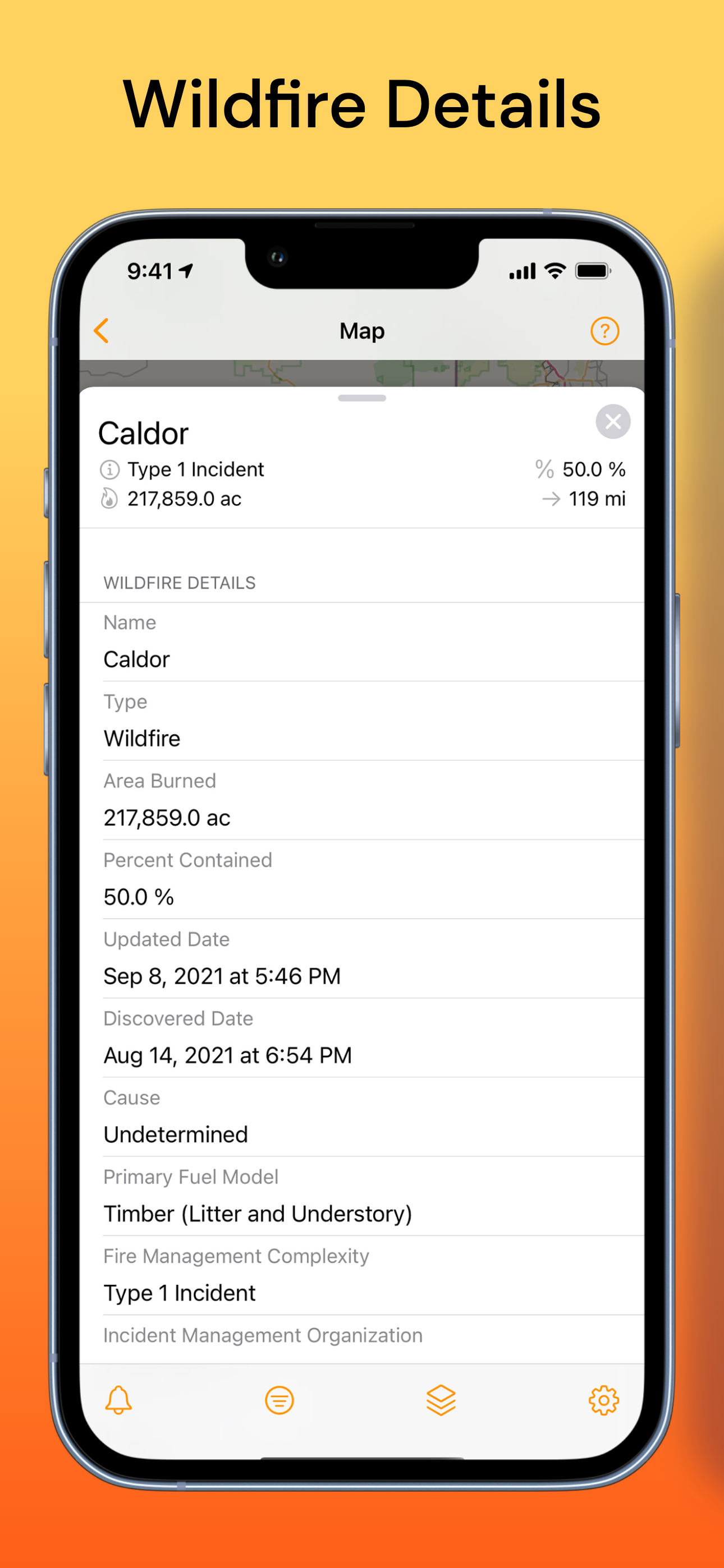
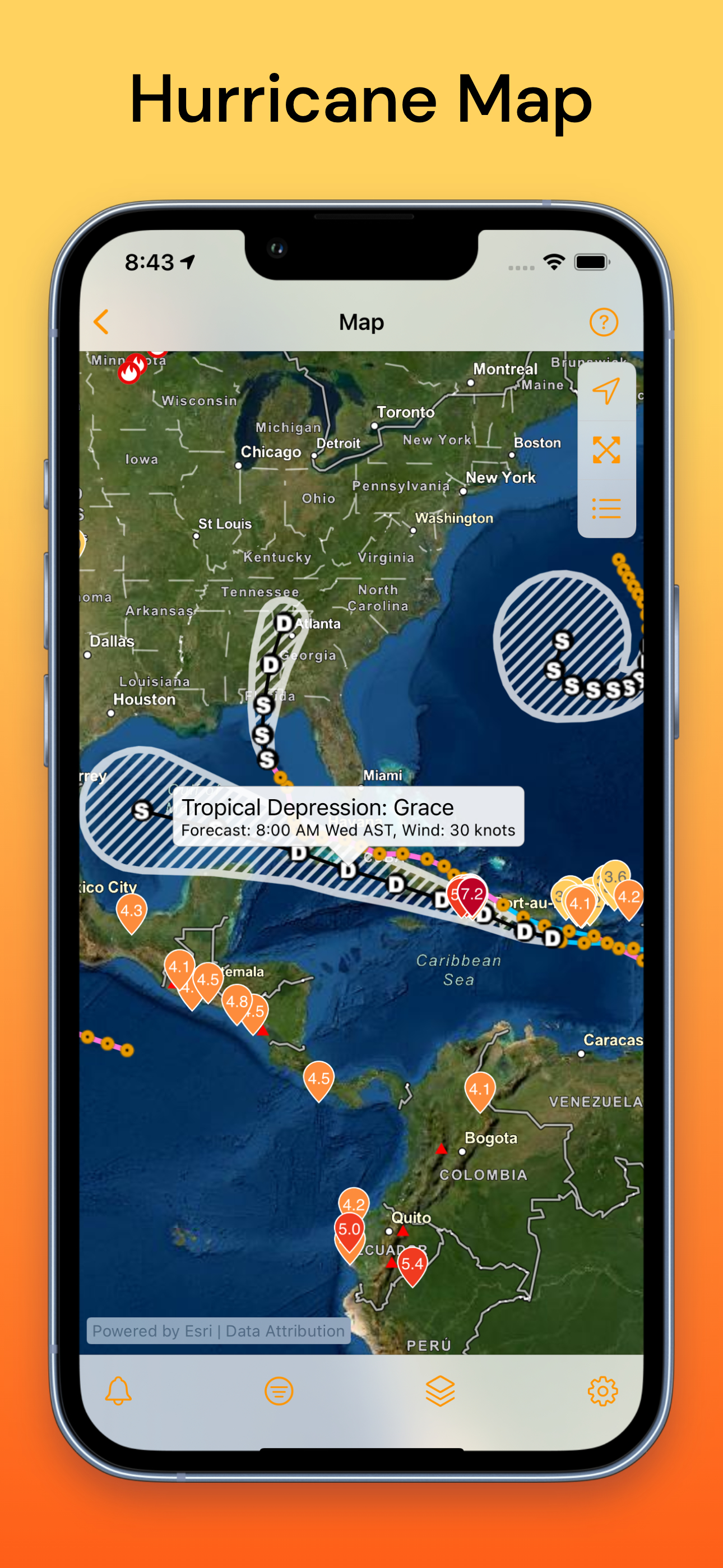
+Wildfires, smoke, hurricanes, volcanoes, and more.
FREE VERSION INCLUDES:
- Nearby earthquake alerts
- Customizable regional alerts
- 3D globe map
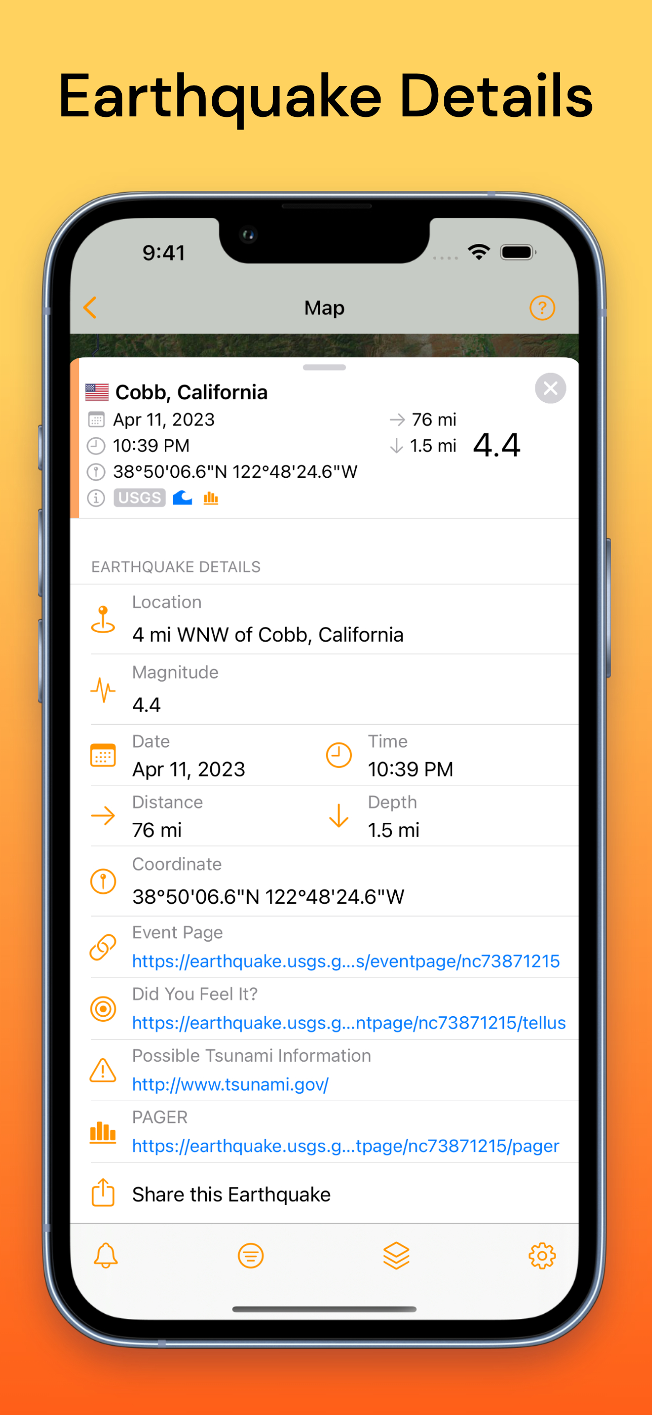
- Satellite imagery and streets map
- Fault lines map layer
- Multiple data sources (USGS, EMSC, NRC)
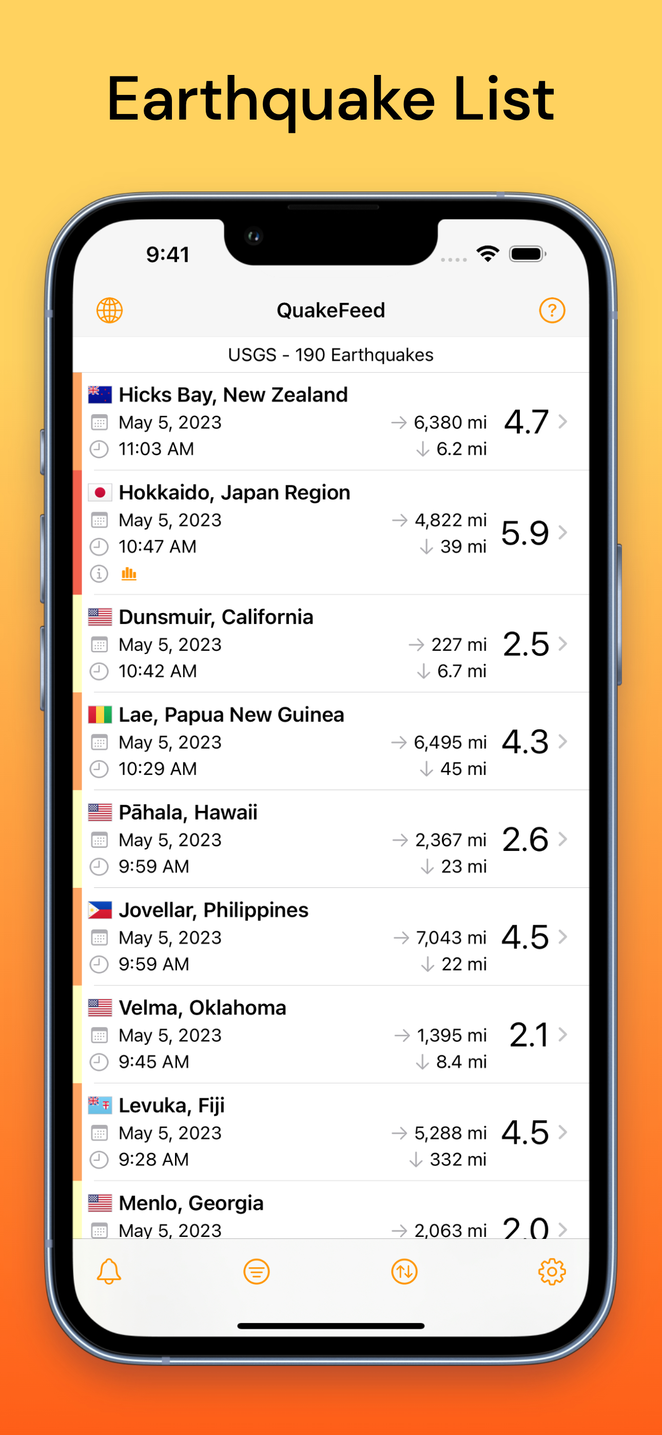
- Search, sort, and filter earthquakes
- Links to USGS earthquake event page
- Links to PAGER and aftershock forecast
- Links to tsunami.gov
PREMIUM SUBSCRIPTION INCLUDES:
- Removes ads
- Wildfires (USA & Canada)
- Smoke forecast map layer
- MMI Contours (shaking intensity)
- Historical earthquake data to 1900
- Eight premium basemaps
- Erupting volcanoes
- Hurricanes
WE RESPECT YOUR PRIVACY:
- No ad tracking
- No data sharing
- Your precise location never leaves your device
If you choose to purchase a QuakeFeed Premium Subscription, payment will be charged to your iTunes account at confirmation of purchase.
The subscription automatically renews unless auto-renewal is turned off at least 24-hours before the end of the current period. Your account will be charged for renewal within 24-hours prior to the end of the current period, for the annual subscription price.
Subscriptions may be managed and auto-renewal may be turned off by going to your iTunes Account Settings after purchase. No cancellation of the current subscription is allowed during the active subscription period.
Full Privacy Policy and Subscription Terms of Service:
http://www.quakefeed.com/privacy/
SUGGESTIONS? QUESTIONS?
Contact us at [email protected] or visit http://quakefeed.com – we usually respond within 24 hrs!
Calificación Promedio
94.74K+
Desglose de Calificaciones
Reseñas Destacadas
Por buttercupps4
2018-10-17
Versión 4.1.6
advertisementsnotificationsmonetizationupdates_and_maintenanceIt's an interesting app that helps to keep me informed on what the earth is doing. I have noticed that I often do not get an earthquake notice for about 30 minutes after it has occurred so you certainly don't want to rely on this app to save your life or give you real-time forewarning. It is useful though, especially if you pay close attention- you can see how an earthquake in one region will stimulate an earthquake in an almost opposite region. In this way, it can help you predict what may happen next. Update: I liked the app much better before it was updated. Before, the map was a satellite image and I could zoom in and explore the topography of the ocean floor and such. Now it’s just a cartoon image. I still gets alerts but I use the app much less now because of the crumby map. And thanks for the adding the ads... I upped my rating back to 5 stars for the developers quick and helpful response and showing me how to get my satellite image back. Thx:)
Por Userkjh
2023-08-20
Versión 6.3
feature_requestsnotificationsWhile the information it provides is indeed accurate, the app's reliability as an emergency notification system is highly questionable. The main issue with this app is its inconsistency in delivering timely notifications. This unreliability can be detrimental during critical situations when every second counts. On the positive side, when Emergency Alert does manage to send notifications, the information provided is accurate and helpful. Additionally, the user interface is clean and easy to navigate. However, these positives are overshadowed by the app's unreliability in delivering notifications. In emergency situations, users need a dependable system that they can rely on without any doubts. Unfortunately, Emergency Alert fails to meet this crucial requirement. In conclusion, while Emergency Alert provides accurate information during emergencies, its unreliability as an emergency notification system severely impacts its usefulness. Until the app addresses its notification delivery issues, it cannot be relied upon as a reliable emergency alert app. To developer: ⭐️⭐️⭐️⭐️⭐️ for your response.
Por Always shaking
2023-09-15
Versión 6.3.2
accessibilityfeature_requestsperformance_and_bugsOur world is experiencing all types of challenges that people are still not even beginning to understand. We all have not considered the reality that our earth is not a dead rock, but every bit as alive no less than our heavens, oceans, animals humans, insects and biology in all ways. Some events have suffered in horrific unimaginable events, as we are seeing almost daily. Our earth is very alive and humanity needs to understand this! Quake Feed is but one source that we all can wake up to and understand earth shifts and turns and continents move about as the world changes axis’s. Weather extremes, with flooding and fire and volcanic activity and melting ice are all life in change. I love this app for it is teaching us about all forms of life within this earth. This app is educational for all people who listen, look and truly accept learning about earth movements and continue change.
Capturas de Pantalla


AD
AD
Aplicaciones Populares