
Paddle Ways - Lets Go Paddling
OnWater, LLC
4.3
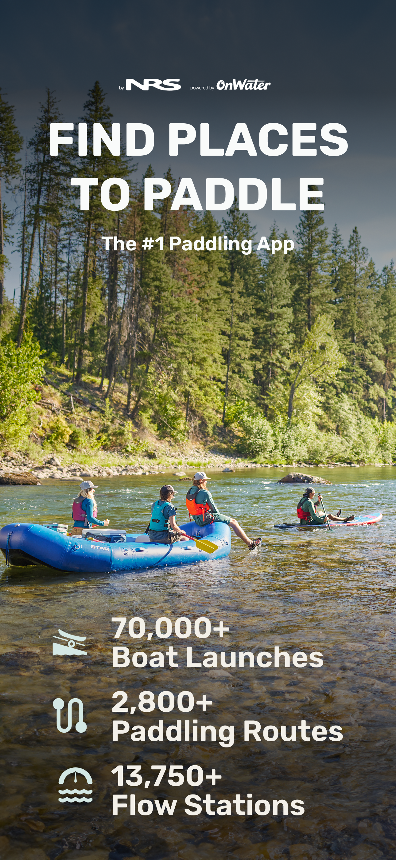
Find New Places to Paddle. Plan Better Trips. Stay Ahead of Conditions.
PaddleWays is your all-in-one paddling guide, built for kayakers, rafters, canoeists, and paddleboarders of all experience levels. Whether you’re chasing whitewater or looking for calm, scenic lakes, PaddleWays helps you find where to go, when to go, and what to expect once you’re there.
Free Basic PaddleWays Account
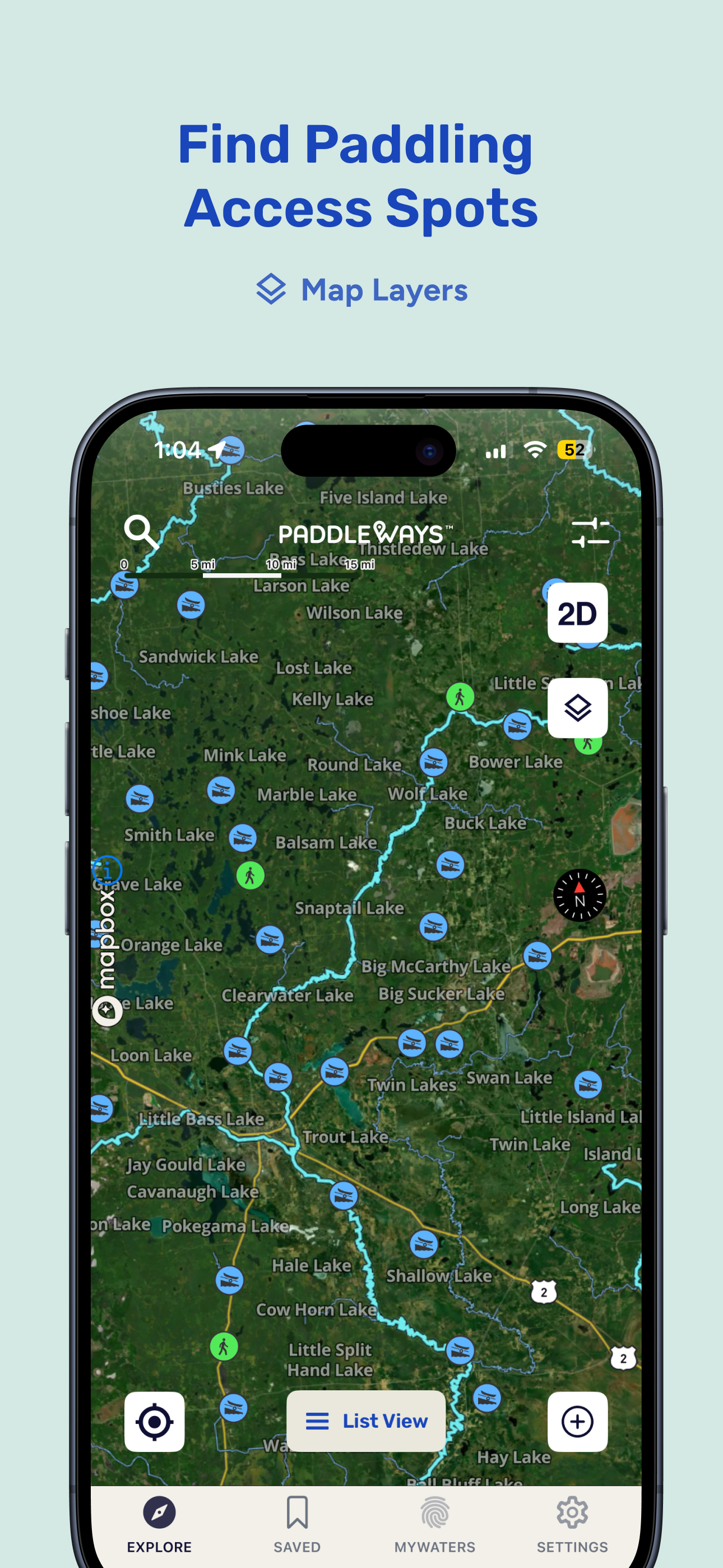
Everyone deserves access to the water. With a free Basic PaddleWays account, you get nationwide access to mapped rivers, lakes, boat ramps, public access points, and thousands of paddling-specific points of interest. PaddleWays+ unlocks additional features for trip planning, navigation, and safety.
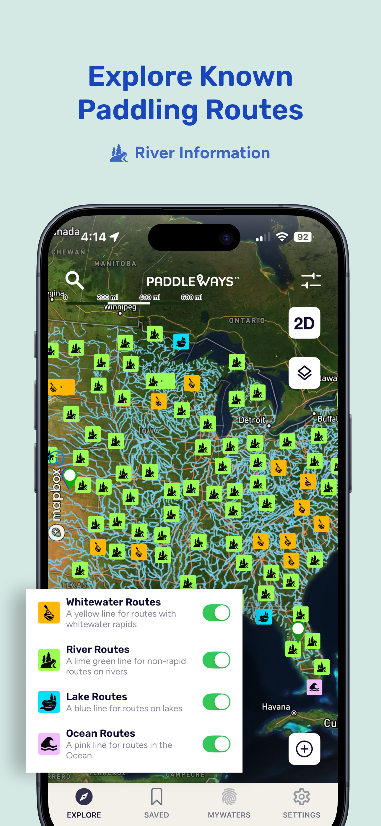
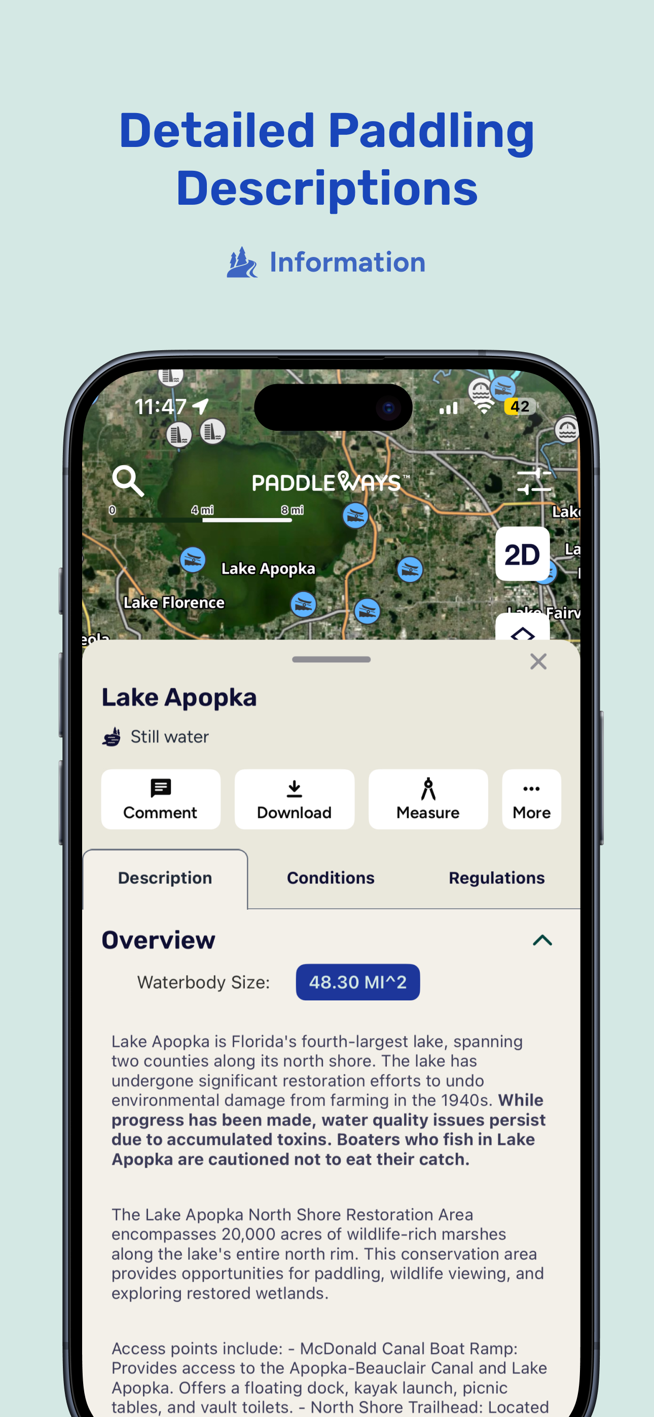
Explore Paddling Routes Across the Country
Discover thousands of mapped paddling routes, from quiet flatwater to technical whitewater runs. Find public launch points, shuttles, campsites, and detailed river descriptions all in one place.
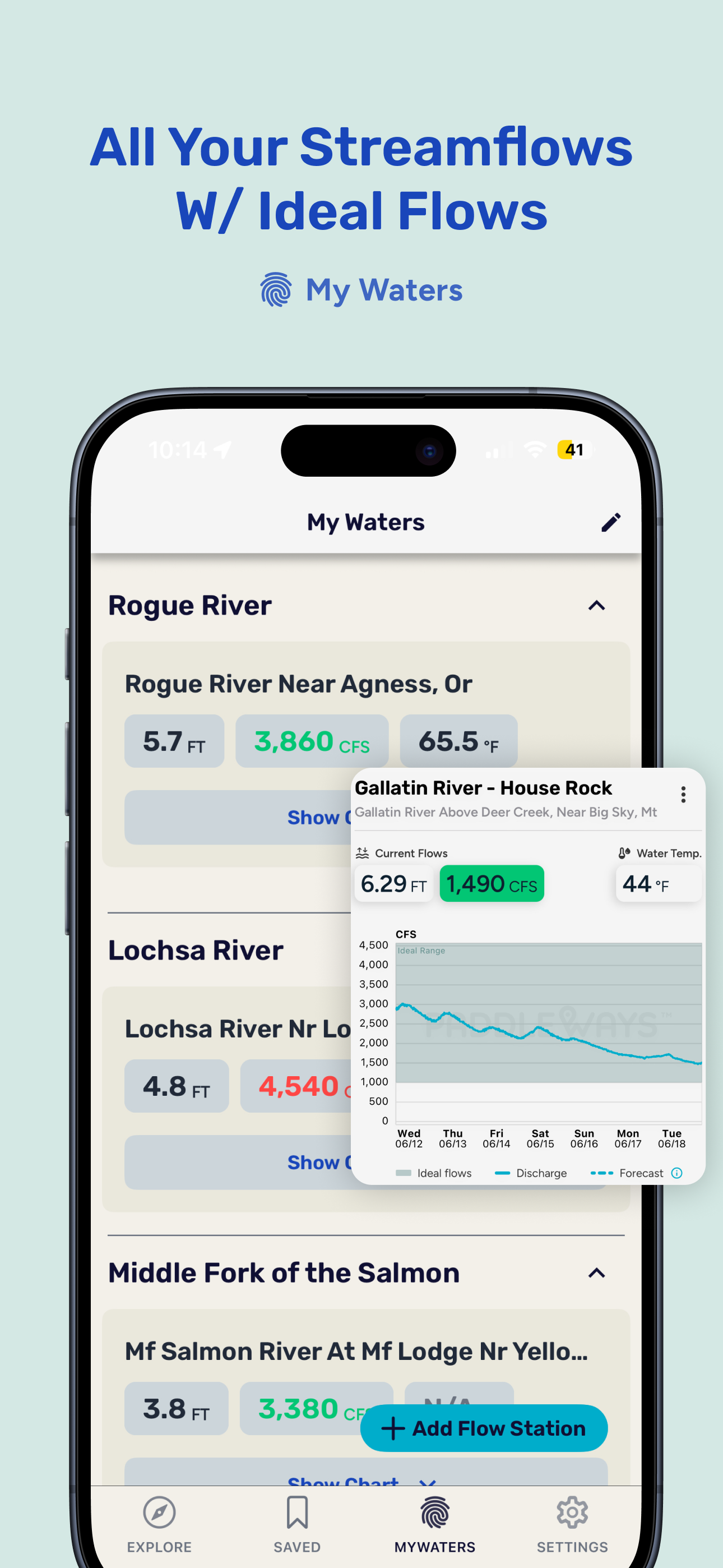
Plan With Confidence
Check real-time streamflows, 10-day weather forecasts, and river conditions before you head out. Use the My Waters dashboard to save your favorite rivers and see at a glance when they’re in shape for paddling.
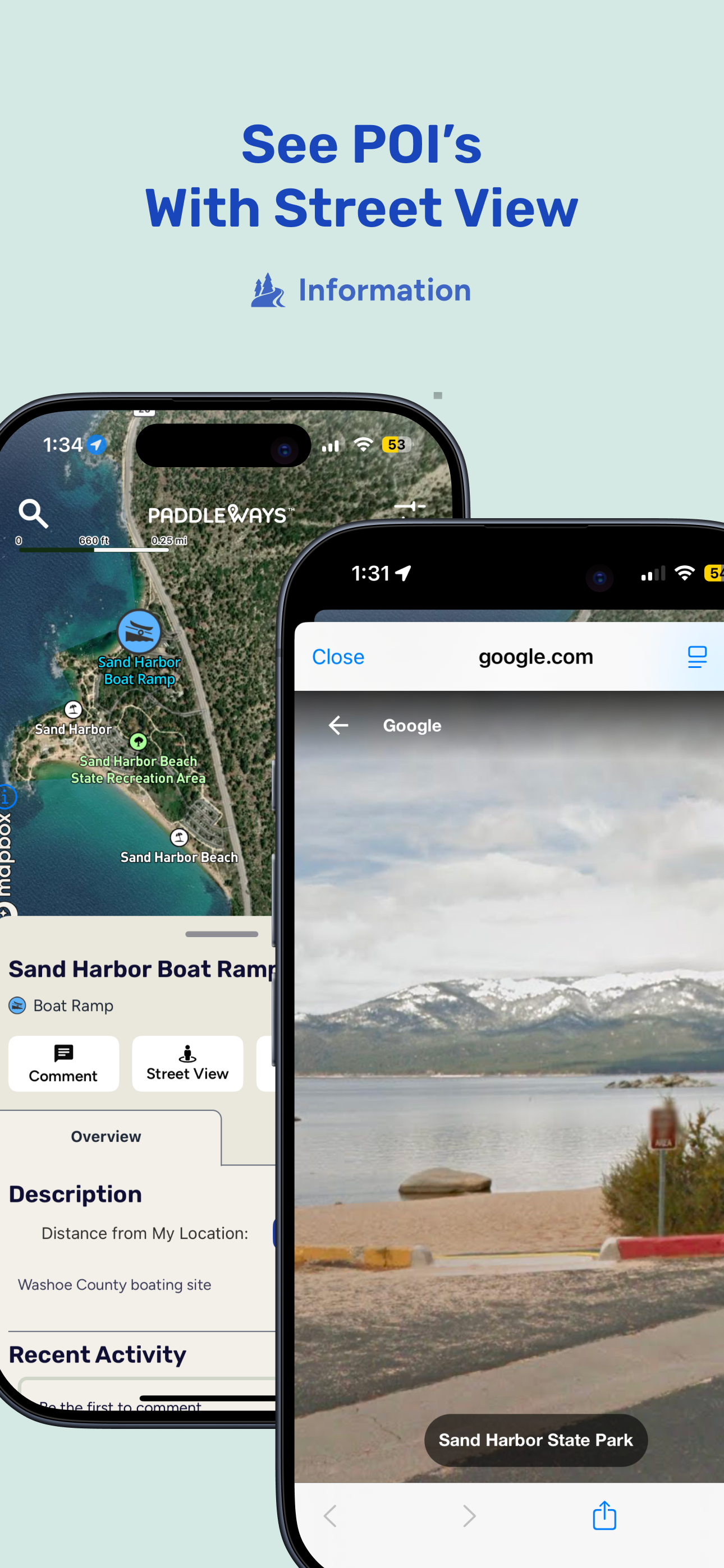
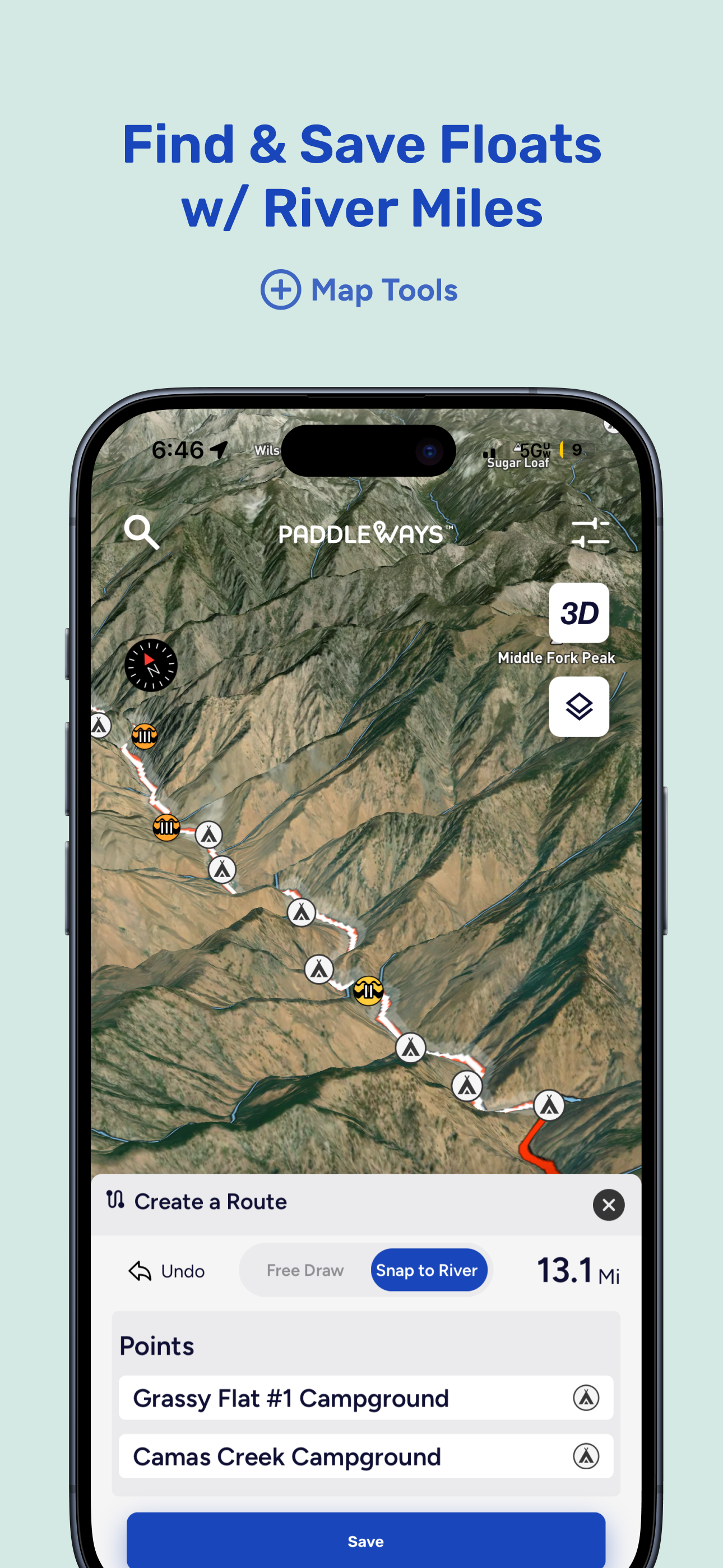
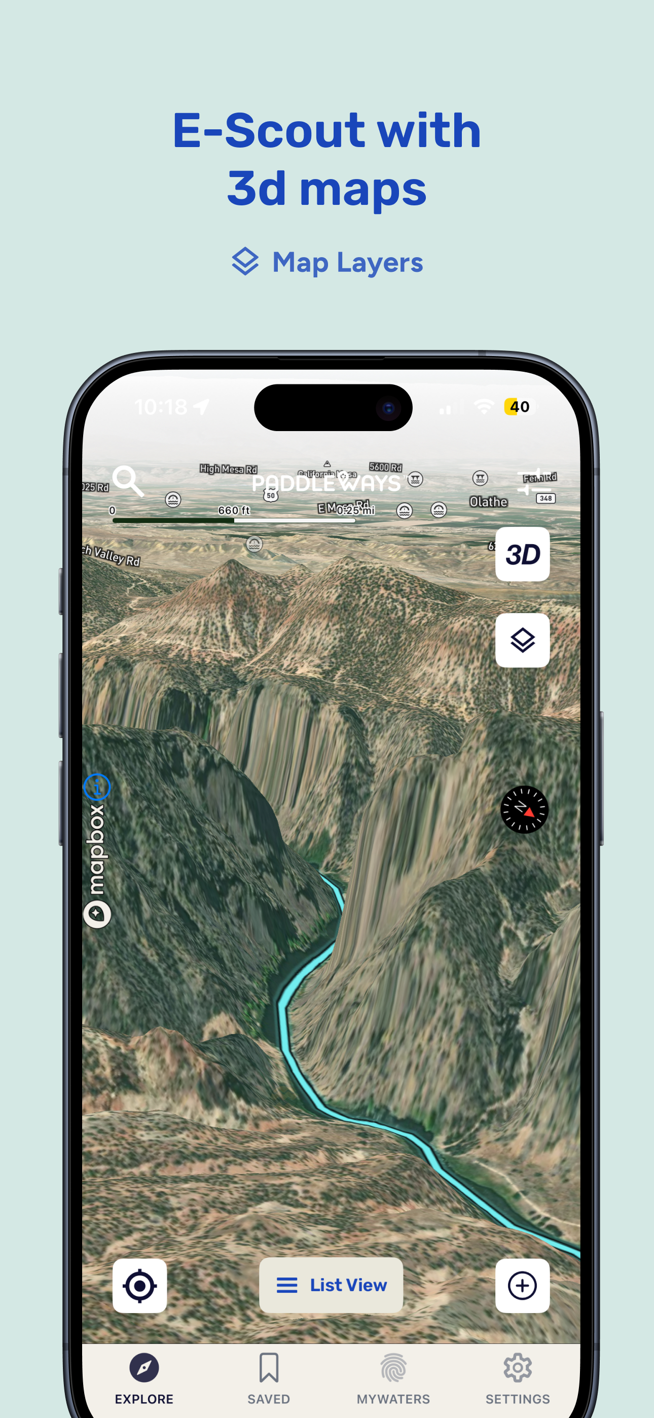
Plan Like a Pro
Measure float distances, find takeouts and campsites, and preview key POIs like access points and boat ramps using Street View when available. Add your own waypoints and save past trips to make planning future outings easier.
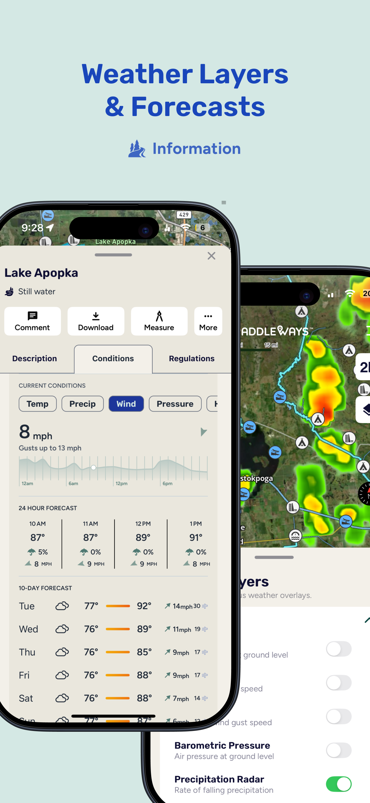
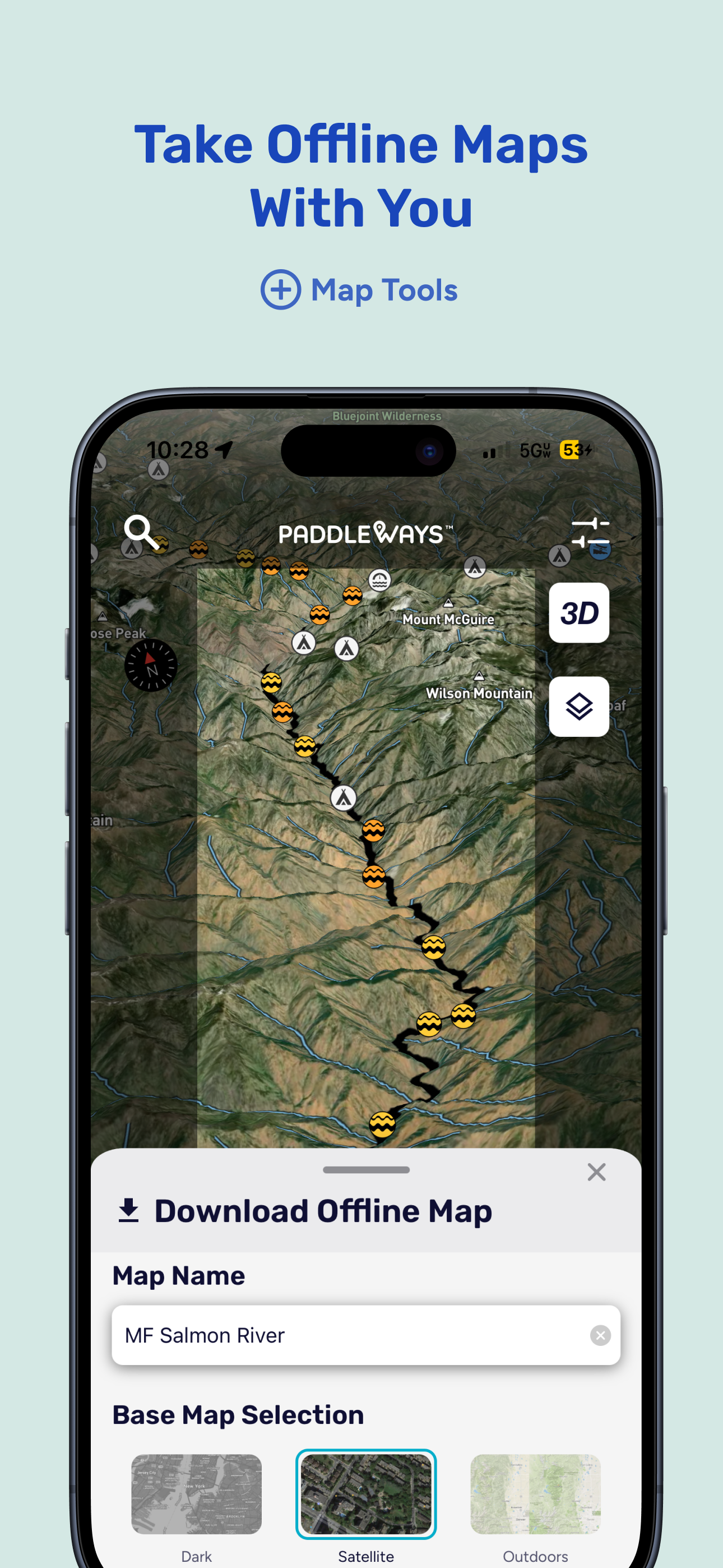
Stay Prepared, Even Offline
Use cell coverage maps to see where you’ll have service. Download maps in advance to navigate without signal. Whether you’re off-grid or close to town, you’ll have the tools you need.
Built for Paddlers. Backed by NRS.
PaddleWays is supported by NRS and powered by technology from onWater. We’re committed to access, safety, and stewardship. Every PaddleWays+ subscription helps fund conservation and paddling access efforts.
PaddleWays+ Unlocks Even More
Upgrade to access premium tools:
My Waters dashboard with unlimited saved rivers
Offline maps and cell coverage overlays
10-day weather forecasts by location
Advanced weather layers including wind, radar, and pressure
Lake depth maps (select states)
Private land ownership info
Download PaddleWays and turn your phone into a trusted paddling guide.
Terms of Use: https://paddleways.com/terms-and-conditions
평균 평가
950
평가 내역
추천 리뷰
zachariahcharles 작성
2023-08-26
버전 1.1.5
accessibilitymonetizationupdates_and_maintenanceVery cool concept. I think it has the potential to be the all in app for everything needed for whitewater paddling if a few things were improved. Continue to look for contributors to add data on rivers since the current data is very lacking. I’d say look to at least have what American Whitewater has in terms of data covered and then continue to add to that with local experts. Next, I find adding data is a bit difficult to be able to scroll down and hit submit. Lastly, in order to be in the premium category, I’d maybe consider teaming up with rain pursuit to get map overlays showing accumulated rainfall. This can help for those runs that don’t have a corresponding USGS gage. I think if the goal is to have this be one stop for paddlers this stuff is a must to get them to spend the money on the app. The ability for users to update will be helpful as well.
Catherinepasini 작성
2023-08-09
버전 1.1.4
advertisementsfeature_requestslocalizationmonetizationupdates_and_maintenanceHopping into the beta test for this - so if you’re reading this review in the future and I haven’t updated it yet, keep that in mind. I have high hopes for this app! Maybe it’ll be like alltrails for paddling. Things I think need some work currently: Needs more content. Only one route near me, but I know of so many more. The boat launch drop in/out locations should have addresses and an info page for parking, restroom access (if any), fees, photos. I’d love to see the ability for users to create their own routes. Lakes should be listed too, with boat ramp info. I SUP a lot on local lakes. It’s strange to me that there isn’t much of a navigation bar - I haven’t paddled yet but I would hope that the app will be able to record my route, and save that in a log. It would be awesome if it had some functionality similar to Strava for cyclists where you have your own profile and can follow others, share your routes etc. Another neat feature would be something similar to Waze where users could mark hazards on the route or create comments for others like “if the water is low stay left here” Pros so far: The app is smooth. No ads are a big plus. The map is beautifully done. I like the list view option (but it should tell me how far the route is from my current location too) This is an awesome concept that paddlers have needed for far too long!
WW Alpine 작성
2024-05-29
버전 2.3.7
game_progressionlocalizationupdates_and_maintenanceThis app is intuitive and visually appealing but lacks helpful content even in the membership version. There are claims about gaining more info on river details yet I only ever get the river distance in its entirety and nothing more besides a few major rivers in my state. Also when you create a route, the lines are wildly inaccurate. That being said, the gauge location/information and general map of rivers is nice to have and it is convenient to be able to save certain river gauges to keep an eye on levels. Suggestion: More river info (a lot more), allow local users to suggest/report boat launches on the map, create more accurate snap-to mapping, allow commenting so local users can share updates and info, incorporate a list of what is runnable like AW has, add important features like dams to the map. I look forward to the developers working out the kinks because someday this will be a fantastic app.
스크린샷
AD
AD
인기 앱