
iNavX: Marine Navigation
NavX Studios LLC
4.8
AD
릴리스 세부정보
| 발행국 | US |
| 국가 출시일 | 2008-08-02 |
| 카테고리 | Weather, Navigation |
| 국가 / 지역 | US |
| 개발자 웹사이트 | NavX Studios LLC |
| 지원 URL | NavX Studios LLC |
| 콘텐츠 등급 | 4+ |
AD
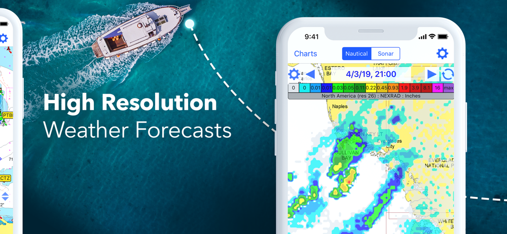
Marine navigation is made easy with iNavX - the world’s #1 handheld Chartplotter. Access marine charts, maps, weather, AIS and more!
iNavX is the only app to give you complete worldwide chart coverage, from all your favorite charts providers, including the ALL NEW iNavX Professional+ Chart series! Fully enabled with one-touch access, iNavX gives users access to the broadest set of marine charts and maps from multiple providers including:
• iNavX Professional+ Charts
• Blue Latitude
• CHS
• Explorer
• Theyr Weather
• Waterway Guide
• … and more
How does iNavX take handheld marine navigation to the next level?
• Sailors - Plan sailing routes with waypoint and route management. Get proactive sail management with GRIB weather forecasts and then keep watch with AIS overlays and integration with your onboard systems. Plus, you can remember your great sailing locations by geotagging photos.
• Boaters - Stay up to date on boating conditions with forecasts that include currents, winds, and swells. Manage your boating equipment with nautical instrument integration and then save great boating routes to share with the track log.
• Anglers - Discover new fishing spots by scouting out holes and inlets. Locate the best fishing conditions by identifying cold fronts and save your best fishing spots with unlimited markers.
Advanced features - iNavX is the most feature rich app available for all sailing and boating needs at a great price:
Advanced Chart Plotter
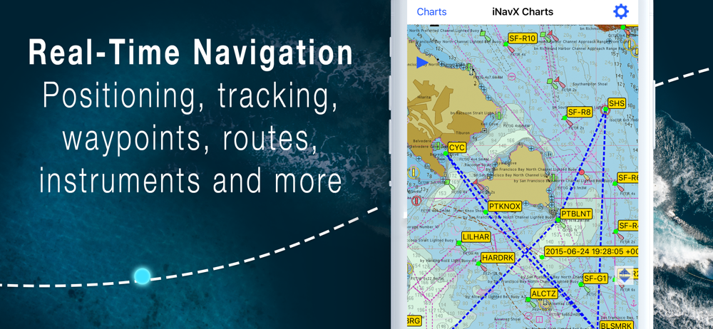
• Plot your position in real-time using your device’s built-in GPS
• Pan, zoom, and rotate charts (including course up)
• Print detailed charts to use in combination with the app
Advanced Navigation
• Create waypoints and plan routes to navigate between them
• Track log allows you to record your route
• Import/export data in KML (Google Earth) or GPX format
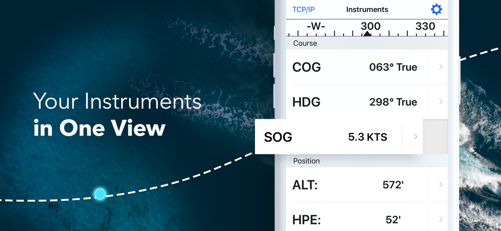
Advanced Instrumentation
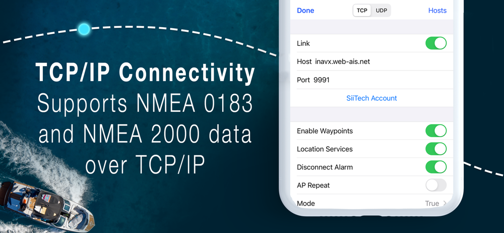
• Supports NMEA data over TCP/IP (using Wifi)
• Integrates with external GPS, AIS receivers & transponders
• Connect nautical instruments: Depth, Speed, Wind, Engine, Batteries, etc.
Essential Toolkit
• GRIB weather forecast
• Tides/currents
• Anchor alarm
• AIS integration
• Port/navaid search
Download iNavX TODAY and automatically receive a complimentary copy of the official and up-to-date high-resolution NOAA RNC United States marine raster charts.
REVIEWS
“iNavX is the original and still one of the best navigation apps.”
– Practical Sailor
“The most full-featured navigation app around and viewed by many as the standard”
– Sail Magazine
“The #1 recommended marine charting app”
- iMarineApps
iNavX is Compatible with: Theyr Weather, Waterway Guide, AIS, Brookhouse, DigitalYacht, ShipModul, vYacht, Vesper Marine, NMEA 2000, Chetco and more.
NEW CHART STORE
Purchase all your favorite charts. Chart subscriptions vary by chart and provider from $9.99 to $199.99 annually, charged to your iTunes Account, which will automatically renew unless cancelled at least 24 hours before the end of the current period. Auto-renew can be turned off anytime by going to your Account Settings in iTunes after purchase. No cancellation of the current subscription is allowed during active subscription period.
NOTE: Continued use of GPS running in the background can dramatically decrease battery life.
MORE INFO
Website: http://inavx.com/
User’s Guide: http://inavx.com/help/
Terms of Use: http://inavx.com/terms
Privacy Policy: http://inavx.com/privacy
Download iNavX: Marine Navigation
Not Available
평균 평가
20.67K+
평가 내역
추천 리뷰
Tiki Rich 작성
2019-05-27
버전 5.5.5
cross_platform_consistencysocial_and_communitymonetizationI really cannot understand the recent (and few) negative reviews... I am slipped in the Santa Cruz, California small craft harbor. I have 20 year old integrated Raytheon electronics (fish finder, radar, chart plotter) and following the tsunami that hit our harbor, I lost the chart plotter functionality. Knowing that to replace my integrated system would cost me over 10K, I 'rolled the dice' and downloaded INavX to 'temporarily' replace the plotter as I was not prepared to haul out, $$$, etc. Well, over two years later I still am not planning a haul out for electronics as... I now am very satisfied with my IPAD/INavX next to my radar and fish finder. I currently have all my fishing and important navigation coordinates loaded and adding new ones regularly with a tap of the stylus. In actuality, don't even miss my old chart plotter... Thank you INavX... Captain Rich Bonny-Matit
Bwana2012 작성
2024-04-21
버전 5.6.32
cross_platform_consistencyI recently tried out the iNavX app on both my iPhone and iPad, primarily attracted by its high-resolution charts. Unfortunately, the overall user experience didn't measure up to competitors like Navionics and Navily, which I find to be much more intuitive and user-friendly. The charts on iNavX are indeed of good quality and detail, which is a strong point for the app. This might be particularly appealing for those who prioritize visual clarity and precision in marine navigation. However, when it comes to ease of use, iNavX falls short. The interface feels less intuitive, and navigating through the app is more cumbersome compared to the smoothness of Navionics and Navily. Given my experience, I'll continue to rely on Navionics as my primary navigation tool. iNavX, while having its merits in chart resolution, will only be used on an as-needed basis due to its less user-friendly setup. For anyone considering iNavX, be prepared for a bit of a learning curve if you're already accustomed to more streamlined apps like Navionics.
Ugg1234567 작성
2022-02-08
버전 5.6.6
advertisementsmonetizationEverywhere you look you would think you can use Navionics Maps - nope, no longer available. Oh, how about C-Maps? These are even listed on recent advertisements - Nope, no longer available. But, you can purchase the INavX maps subscription for $60, in addition to the cost of the app. Or, you could go straight to Navionics and use their maps for $20 with their free app, or go to C-Maps and use their maps for $15 with their free app. Oh, but INavX does let you use the old NOAA raster maps for free, but then so does pretty much every other free app out there. Might be a good app - don’t know, not going to pay 3 to 4 times more for their maps than the extremely highly rated and industry standard Navionics or C-Maps. Knowing this in advance I would have never purchased this app.
스크린샷


인기 앱