Tactical NAV
TacNav Systems LLC
3.7
AD
Detalhes da Versão
| País do Editor | KR |
| Data de Lançamento no País | 2011-02-14 |
| Categorias | Navigation, Productivity |
| Países / Regiões | KR |
| Website do Desenvolvedor | TacNav Systems LLC |
| URL de Suporte | TacNav Systems LLC |
| Classificação do Conteúdo | 4+ |
AD
BACKGROUND:
Built from the ground up in the rugged mountains of eastern Afghanistan, Tactical NAV (also known as TACNAV-X) was developed by a U.S. Army Field Artillery officer with the vision of crafting a low-cost and highly accurate mobile navigation platform tailored for the U.S. military.
Tactical NAV’s journey began in the Pech River Valley and the Korengal Valley in Kunar Province, Afghanistan.
U.S. Army Capt. Jonathan J. Springer, a Field Artilleryman serving as a Fire Support Officer with the 101st Airborne Division (Air Assault), embarked on the development of this tactical navigation platform immediately following the memorial services for Spc. Blair D. Thompson and Spc. Jared C. Plunk, who were killed in action on June 25, 2010.
Despite initial rejections by the Department of Defense, Captain Springer remained steadfast in his mission to continue developing Tactical NAV — even to this day. His ultimate goals were (and still are) to make a positive difference for other soldiers and service members and to honor the men and women killed and wounded in battle.
He used his life savings to fund and develop TACNAV-X, all with the ultimate hope of saving military lives, and helping his fellow service members in accomplishing their missions at home and abroad.
Tactical NAV officially launched on the App Store on February 14, 2011.
BUILT FOR ACCURACY:
TACNAV-X’s performance accurately matches that of the AN/PSN-13 Defense Advanced GPS Receiver (DAGR).
MISSION:
Empower military service members with a highly accurate and powerful mobile navigation platform.
VISION:
Assist and support our nation’s service members with their mobile navigational needs and enable them to operate and win in both training and combat environments.
BOTTOM LINE:
Tactical NAV has successfully undergone evaluation against other software platforms and devices such as Nett Warrior, ATAK, and BFT. Its accuracy is within 1mm of these officially approved systems issued by the DoD.
IAPs & SUBSCRIPTIONS:
Tactical NAV offers in-app purchases (IAPs) and subscriptions. Currently, tactical drawing mode is available as an in-app purchase, and offline mapping mode is also accessible to users as either a monthly or yearly subscription.
All revenue generated from these features contributes to further developmental coding and updates, and a portion of the proceeds are donated to charities that specifically benefit disabled veterans.
KEY FEATURES:
• A military-quality precision targeting platform
• Purpose-built for the individual Soldier
• Offline mapping capabilities (complete usage of the app with no emission of a cellular signal)
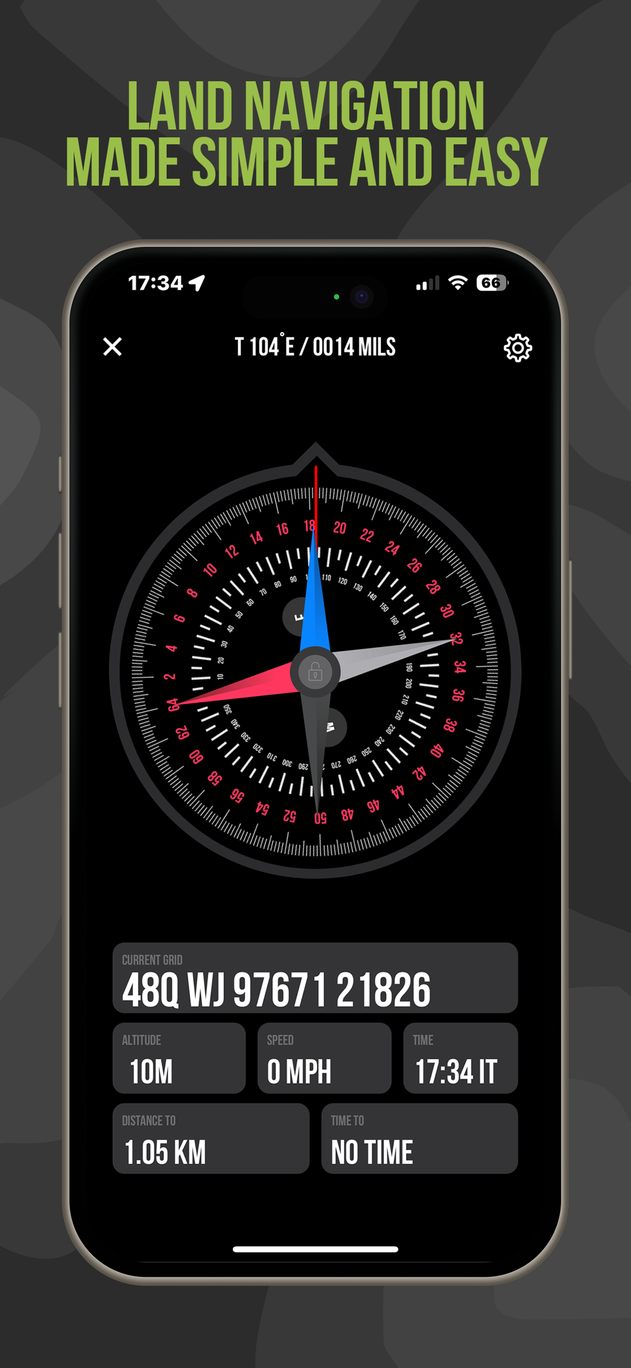
• WGS-84 standard (MGRS, UTM, BNG, and USNG coordinates)
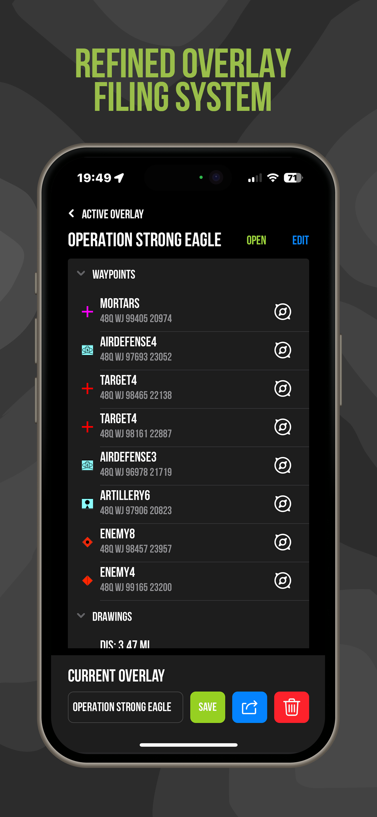
• Tactical drawing mode (useful for mission planning, building overlays, targeting, etc.)
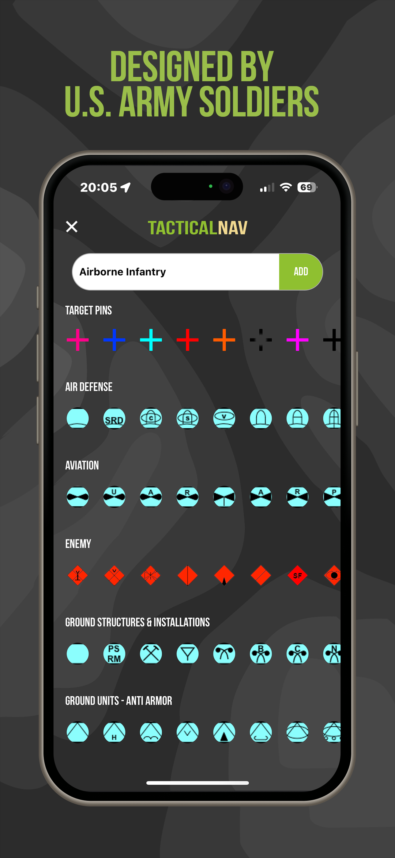
• Waypoint plotting functionality with military graphics (per FM 1-02.2)
• Compass “FastLock” function for capturing quick and precise azimuths
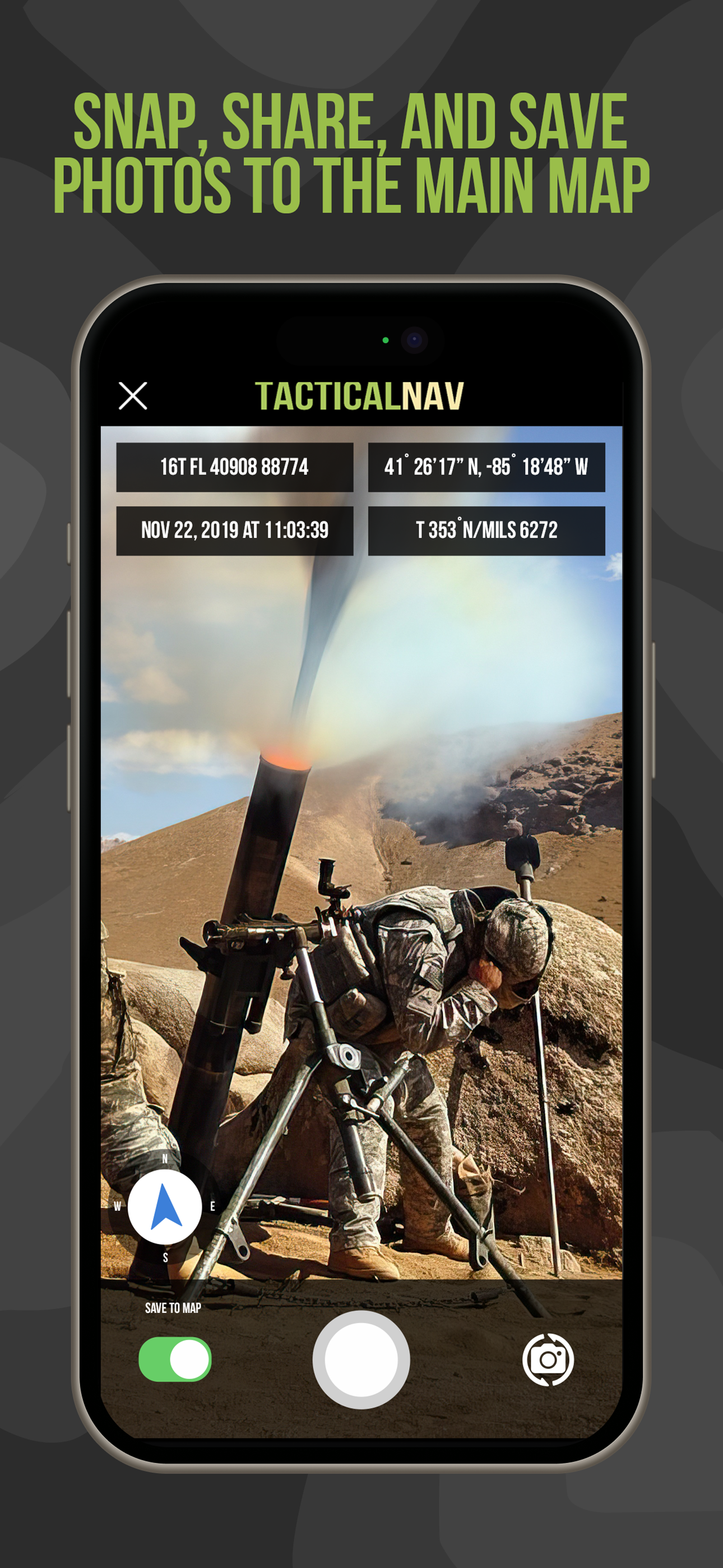
• Snap and save photographs onto the main map to increase situational awareness
• Location, waypoint, and photo-sharing capabilities (via email and text)
• One-button night mode function for low-light situations
• ‘Go to Grid’ feature for precision planning, drawing of overlays, and dropping waypoints
• Real-time weather and temperature information
• Apple Watch app included for free
• Rigorously tested to ensure utmost accuracy and reliability
• iOS/iPadOS native code built for austere and contested environments
IMPORTANT NOTES:
The Department of Defense does not endorse Tactical NAV and TACNAV-X, nor should it be used in life-threatening or combat situations in place of a government-issued device.
SUPPORT:
If you have any questions about the app, please contact Jonathan Springer directly at [email protected].
Avaliação Média
3
Desagregação das Avaliações
Avaliações em Destaque
Por 짱죠80
2014-04-04
Versão 3.04
Feature RequestsHate itLove itIt needs more functions. Distance between points ... based on real road. Map resolution is not good. When you enlarge the map in app you can not see the details. Korean map apps such as naver map and daum map is much better than this app
Por hyun11160
2017-11-04
Versão
으흠씨 5년전에 받고 좋다고 받았는데....... 뭐 ...가 ...좋은지 모르겠습니다......
Por 으흠ㅋㅋ
2012-07-01
Versão 2.8
Location처음쓰는 스마트폰에 처음쓰는 gps어플이지만 정말 굳!!! 로딩도 빠르고 10계단 좌표, 방위각, 밀각까지 군사용으로 모자르지 않는 성능!!! 다만 표고가 없는건지 못찾는건지 그게아쉽네요ㅋㅋㅋ
Capturas de Tela


Apps Populares